
|
The extraordinary 2023 thunderstorm season continues across Ireland and UK with yet another big set-up in what has been back to back non-stop convective action on so many consecutive days that the season has already beat my previous best chase season in 2009. The previous evening Roisin and I had just arrived back from chasing storms at Mullaghmore in Co. Sligo, this was our second chase to Sligo in as many days and our third within a week so we had put in a lot of hours and had got rewarded with great storms every single day, it seemed this was the season which just keeps on giving!
I've never had a season before in which I've got on such high quality storms every single time and have had such high confidence in the set-ups that I just knew I was going to get storms once we hit the road, there was no doubting at all, this was an attitude unheard of from me before. In all my previous chase seasons going back more than twenty years I've always had to accept busts, let downs, and long days between the action before the results came, this was always the way, but not 2023, it seemed nature was showing off with vengeance. I also knew from personal experience that when nature does something unusual like this then one must put in the effort and be as dedicated as possible to reap the rewards for no one knows just who much longer this lucky streak was going to last so I gave this thundery period my very best effort and 100% commitment.
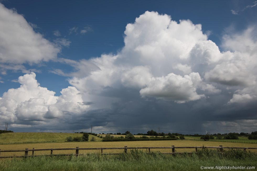
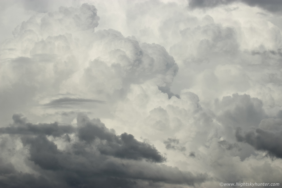
I knew Monday June 19th looked very good yet again and after I got the footage and images off all my memory cards and recharged the batteries the previous night I finally got a chance to relax a little and study the convective potential for Monday. I already liked what I was seeing, in fact, this was the perfect kind of set-up for Summer storms which I enjoy the most. More than 1000j/kg of CAPE widespread across the country with LIs of -4 and -5 in a warm humid air mass primed for storms. The air was much cleaner so visibility would be excellent and the flow was my favourite SWly with cloud tops colder than -40c. There would be 20 knots of deep layer shear which meant organization into multicell modes, furthermore models indicated a SW-NE convergence zone across Ulster which would be the focus point for strong storm formation and possibly even funnel clouds or weak tornadoes.
What I really liked about this set-up was that I didn't have to drive to Co. Sligo for the fourth time and that I now could chase more local through some old favourite locations which were both scenic and which I knew intimately, but where was the best target area? In theory anywhere in the country could see storms with such widespread instability, however the midlands, E, NE and SE looked the best potential, ideally I would need to get close to that convergence zone if one could develop. GFS had been handling storms well in recent days so I decided to trust its guidance which suggested the strongest chance of convective precip was the Co. Antrim coast all the way to NE coast, then perhaps 10-15 miles inland of this area with greater potential over Co. Antrim. I had several locations based on this, the Ballymena or Ballymoney area, or the north coast itself with the option of going back inland to Coleraine and working from there if I needed, so I decided on the coast plan.
The day was another stunner, warm and humid and solar heating was very strong. Today I would be chasing solo, except Rhua would be with me as always. I grabbed snacks in the shop, brought plenty of water then at 11.00 I hit the road and began driving north in a casual fashion but with focused intention. My mind-set was open and happy, you see in a typical N. Ireland storm season there's often very few days each Summer in which to catch something dramatic, that warm season clock is always ticking so you feel the pressure to score because you can be certain that if you don't the season will fly by and it will be over and the next you know it will be Autumn and you have to wait another year to get a chance again. This pressure can often cause tension and anxiety and it's not a good mind-set at all.
I was smiling because I was free from all this pressure, I already had four chase days behind me so I felt completely relaxed, if I didn't score today I wouldn't be annoyed about it as I literally had hundreds of images and dozens of video clips to sort out from the recent chases anyway so I felt completely at ease yet quietly optimistic that my decision making would be good yet again, now it was just all up to nature. I was tired from chasing the last four days and had little sleep yet it didn't matter as I was absolutely buzzing with that glow one gets when they have an unforgettable experience out in nature, the last time I felt like this was in 2020 when I was 'chasing' comet NEOWISE for over a week, in other words I felt 'in the zone'.
I stopped off in Garvagh, got more snacks from a shop and waited in a car park, I considered it a neutral position before making any rash movements, sometimes in chasing its better just to not move at all until your gut tells you otherwise. I filmed a vlog, walked Rhua and kept an eye on the sky, nice updraughts were developing over this area which was a good sign. Despite being early days yet I checked radar and could see showers and cells with red cores already present over Ballymoney and moving off the NE coast, that was interesting to see so early, my instincts told me this could be the convergence zone (Cz) taking effect but I decided to hold back and give it time. There where also red cores off the north coast and over Donegal and Lough Foyle where there was a recent spark. For some reason I felt a strong compulsion to target the coast, it would be a gamble but my instincts kept saying to go there, I could always go back inland if I needed to anyway, but the prospect of seeing a cool storm or even a funnel over that famous coastline or over the sea would be a special experience. Even though I was very content with the storms I had captured at Mullaghmore I was still after good structure or a funnel, so this day was devoted to that goal so I began driving north once again.
 |
A few miles outside Coleraine I pulled over to shoot this developing cell, in fact, this was likely the same updraught I watched developing over Garvagh, it was now much taller and had the first precip core I'd seen of the day. I was now certain this was the Cz extending from here to NE, you can see the line of towers extending into the distance in that direction. Half an hour later this cell turned into a thunderstorm near Ballymoney with a few more strikes off the NE coast, there was no question about it ,this was the Cz, when nature reveals a pattern like this early in the day that's a sure sign its going to do it again later in more dramatic fashion so this bared close watching, however in the meantime I continued to the coast.
 |
I arrived at the sunny Co. Antrim coast during the early afternoon and pulled into Magheracross carpark to enjoy the view. Rhua and I walked around the area, did another vlog and watched convection all around us. Despite the warm sunshine I could feel a breeze coming on shore heading inland, this nailed my hunch, this was the sea breeze Cz, that was moving inland meeting the SWly flow and meeting to trigger convection. I also watched several minutes of rotation approximately 1km away from me. I spent an hour here, however I was starting to loose faith in the sky, there where towers over the sea and inland but they looked capped and lifeless and what I did see wasn't photogenic either so I returned to the van feeling somewhat defeated, maybe this day would be a bust after all, a few rumbles here and there but nothing to get the camera trained on, I also knew it was early days yet.
I took another look at radar, more red cores again near Ballymoney, that area was talking constantly, however I also saw cells over the Sperrins and near Derry moving NE towards the Foyle area and coast, there had been recent sferics from those inland, I decided I needed to make a move somewhere. I couldn't decide where so I just started driving through Portrush with the intention of letting my instincts make the decision for me once I approached Coleraine. As I drove I could see the Ballymoney cell to my left, it looked big, the base was low yet it didn't look that impressive to justify driving off in that direction, or maybe I should go? I didn't know what to do, then I thought of the cells to the W, if I went to Gortmore Viewing Point on the north coast then I would have a great view of those over the Foyle, what to do?, I felt tugged one way then the other, a roundabout was approaching, I would need to make a decision within 30 sec's, I chose Coleraine then Gortmore. My reasoning was that if I went to Ballymoney I could end up being under precip cores all afternoon with nothing to show for it, this would prove to be a very important decision but little did I know it at the time.
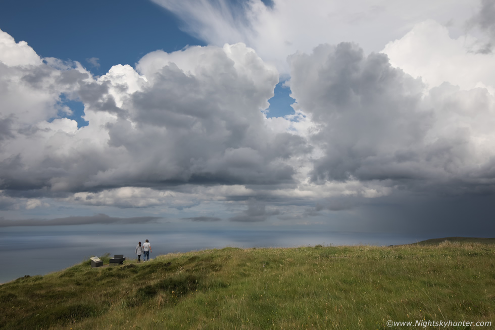
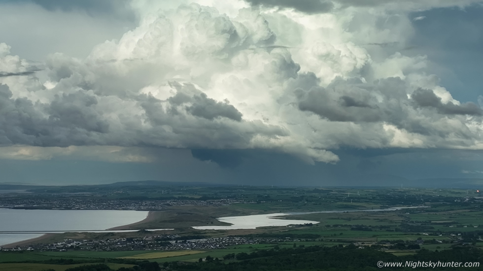
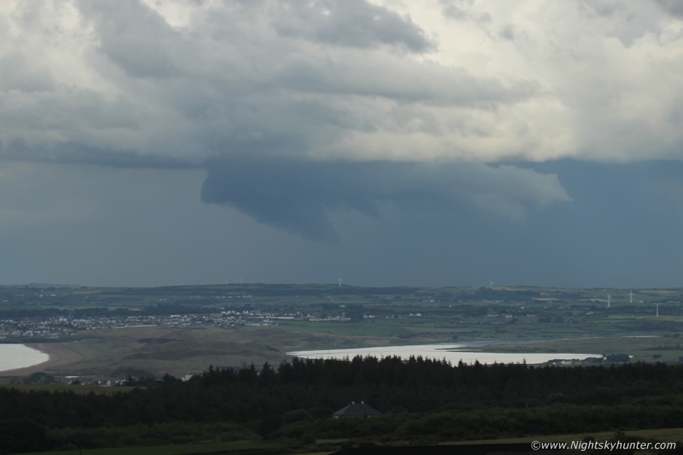
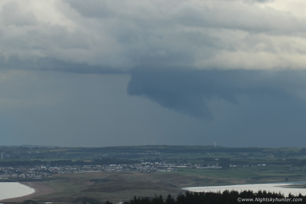
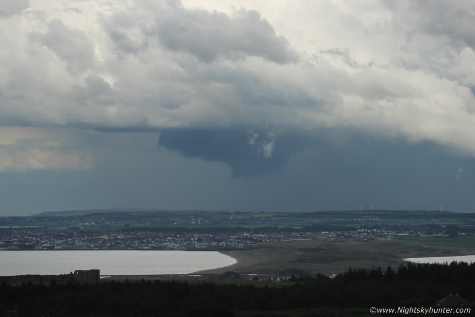
I arrived at Gortmore, it was very warm and sunny with a keen breeze, Rhua and I walked onto the wild grass and sat down in the heat to enjoy the sky as tourists walked back and fourth. For some reason I felt glad I had came here, even for Rhua to get a treat, the view was remarkable, it never ceases to amaze me, it was worth the gamble if I got one nice cell over this dramatic location with Lough Foyle and Donegal in front of me, Atlantic Ocean to my half right, Benone, Portrush and beyond to my right, it was perfect. I then got a phone call from my Dad, he was working off Portstewart in a boat and said they had just got thunder, I said that's unreal as I had only left that area half an hour ago, but at least things were changing, perhaps the cap was eroding away after all. The above image was my view from Gortmore with convection and the core on the right was the Portstewart storm with a fluffy anvil on top.
I decided to just say where I was and wait, then a rumble of thunder came across the Foyle, a big updraught had appeared over Co. Donegal, I finally had a storm and my first thunder of the day. It was just the one rumble and the tower weakened and it wasn't camera friendly again. I watched a large cell growing over the Sperrins moving slowly towards Binevenagh, this one was my next chance, perhaps this was going to be the main catch of the day. John Fagan rang me, he was chasing at Beaghmore and got a storm, but he had similar complaints, the cell was mushy with no structure and just a couple of rumbles, just a garden variety pulse cell. Then the Sperrins cell approached me, it did nothing and the structure was rubbish too and it fell apart and while doing so it brought half an hour of annoying rain so Rhua and I went back to the van for shelter.
It was already late afternoon and I had nothing to show for this chase, I was seriously considering heading home and just calling it a day feeling content with what I already had in recent days but something told me to stay. The CAPE was present all evening well past 21.00 so there was potential yet, I decided to trust my instincts and hold out for longer and just as I was trying to talk myself out of that I got a phone call from Nigel McFarland. Nigel had just finished work and was asking where I was, I said I was at Gortmore and was tempted to go home as the sky wasn't talking but he said he would drive up to meet me, if it wasn't for this phone call I may have drove home.
Nigel and I spent the early evening at Gotmore, the sun came back out and we just chatted away and enjoyed the sky. We did see impressive cells over the sea building but they where too distant for structure shots, but we watched their bases anyway for waterspouts. More dark cells formed over Donegal opposite Magilligan Point and since there was nothing else happening we walked out to the edge of the cliff and began shooting those. The towers were quite tall so we were shocked there was no thunder, Nigel set up his DSLR with lightning trigger anyway and waited, it was worth a shot. I felt like doing something productive so I got the drone in the air, filmed the Donegal cell (not worth posting) and tried flying slowly around Nigel standing beside his camera, I decided this would be good training and besides it would be nice to have as B roll for my end of year video.
 |
By late evening storms had fired over Co. Antrim again but they where to distant for us, Nigel decided to head back home then Roisin rang and asked me to come back home too, I was getting tired and nothing was happening so I said I would leave now and should be back home soon. We were literally just leaving when we turned around and saw this to our S behind the tree tops of the forest at Gortmore. There was really impressive convection forming but we just assumed it was high based and didn't have much depth, but I decided to take out the 100-400mm lens and get shots, this actually was really cool looking.
 |
We parted company and I said to Nigel I would keep an eye on this convection during the drive home. I was half tempted to shoot a time lapse of this convection but tiredness and too much time in the sun were affecting me so Rhua and I got back in the van, and we had good intentions of heading home.
 |
I couldn't see the horizon from our vantage point but as I drove back down the steep hill along the coastal route I entered a clearance and was stopped dead in my tracks. That convection was actually developing into a big cell and it was much bigger and further away than I thought, it had a low base and a precip core was already dropping and it looked great, this actually looked like a storm brewing, I pulled the van in tight beside a hedgerow on the steeply inclined road and got out for a few images. Moving R to L (SW-NE) here on the sea breeze Cz.
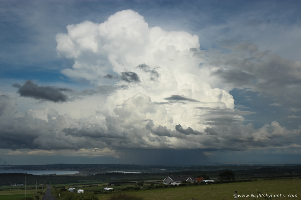 |
Now I was glad I had stayed late, this thing was erupting skyward by the second, it already had a huge tall updraught that was leaning over in the 20 knots shear with a rock solid anvil forming, it had a well defined base and convective updraughts seemed to be boiling all over it, the cap had broke big time, this was the classic loaded gun scenario unfolding.
 |
I swung both rear doors open and got the DSLRs out from the kit bag and got the lenses ready, I knew this was going to be a show which would require everything in my possession. Distant thunder rumbled across the silent evening landscape, I got the 100-400mm back on and began shooting the impressive convection on this storm, panning from bottom to top documenting all the updraught plumes, the contrast and textures were gorgeous. I heard a car approach behind me, slow down and stop, turned out it was photographer and famous glider pilot Owen Anderson. I hadn't seen Owen in a long time so it was cool to run into another storm photographer while in the presence of an actual storm, we immediately began talking about what was happening with much excitement, Owen explained he had seen the tops of this cell from his house, grabbed the camera, and raced out the road where he ran into me.
 |
Owen and I where in awe watching this storm which went from cool to epic within minutes. I had the Mavic 3 Classic drone in the air shooting video clips, the good thing about this drone is that it has cruise control, all I have to do is select the R2 button and it copies all my stick input, that way I can take my hands off the controller and let it do it's thing. I had it slowly flying forward, backward ,and in slow arcs on auto pilot, at 80m to 100m high the the drone was safe so I set the RC on the roof of the van then began shooting with the DSLRs, the 5D and 600D with 15mm, 18mm and 100-400mm lenses constantly back and fourth.
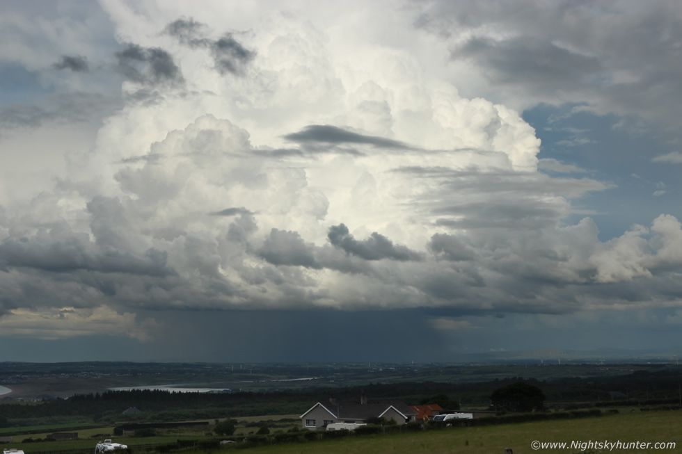
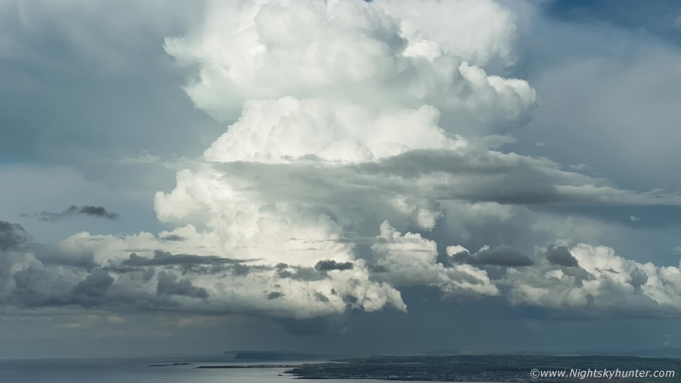
Owen climbed up on the grass verge and onto a stone wall to extend his tripod over a wire fence, from there he had a great view across the horizon, he then connected his lightning trigger to the DSLR and left it to it's devices, it wasn't long before we heard it click the shutter and thunder followed. The above image is 18mm on crop sensor, check out that structure, the principle updraught and anvil were too tall to fit in the 18mm frame, the cell was a good 15km distance from us too. For those who know their storm structure you will have no doubt clocked the wall cloud below the base.
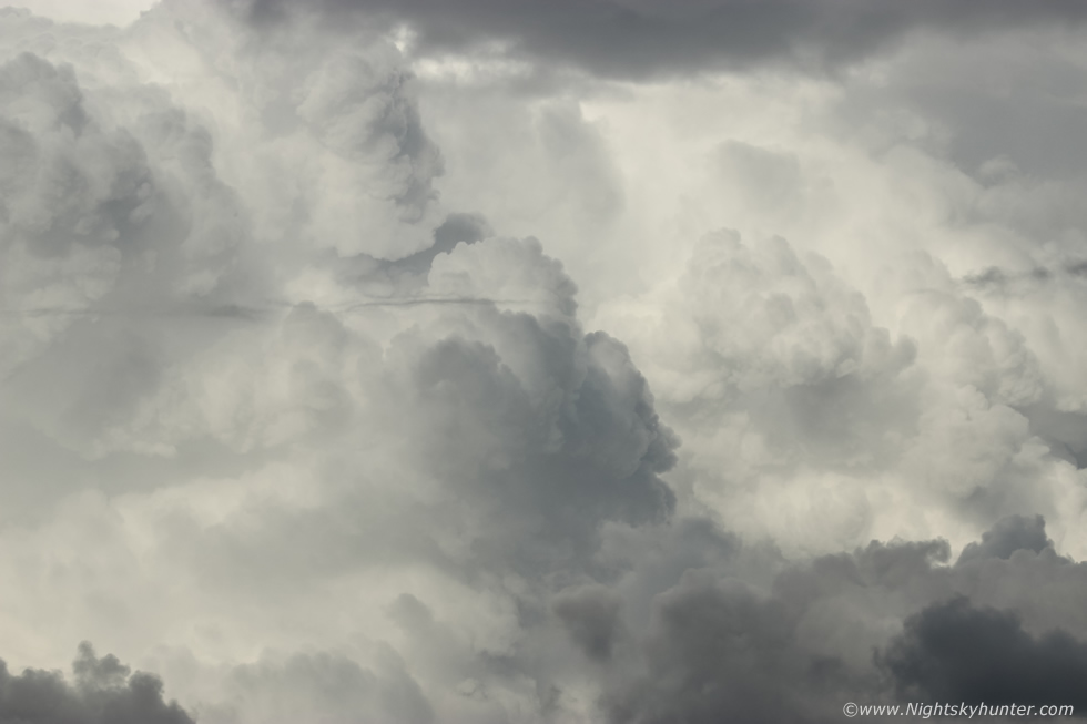 |
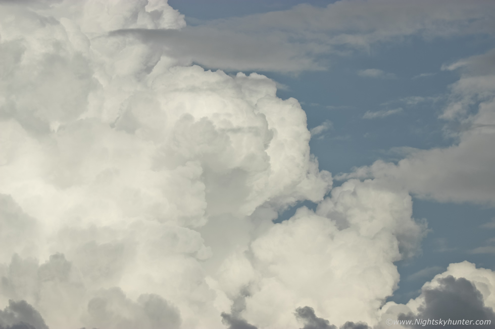
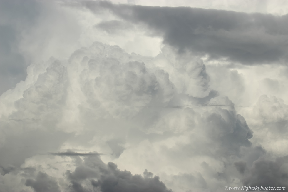
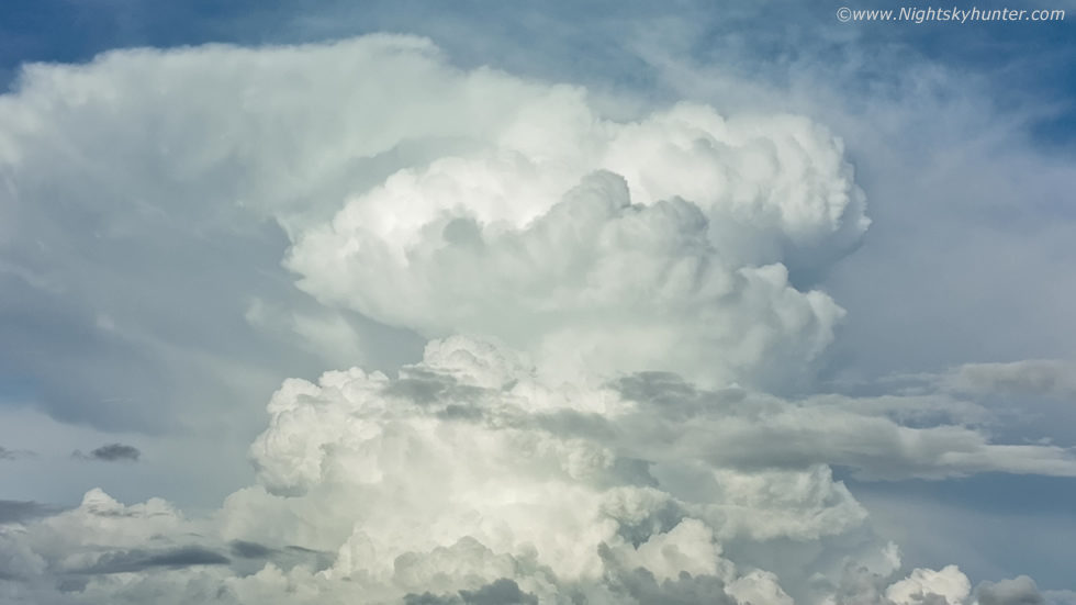
With the 100-400mm I began working my way up and down the updraught, I must have taken 30 images, there were just so many updraught plumes and convective structures to shoot on this storm and they looked dramatic and of very high contrast, I really liked the grey and charcoal tones against the white background, it looked like a volcanic eruption.
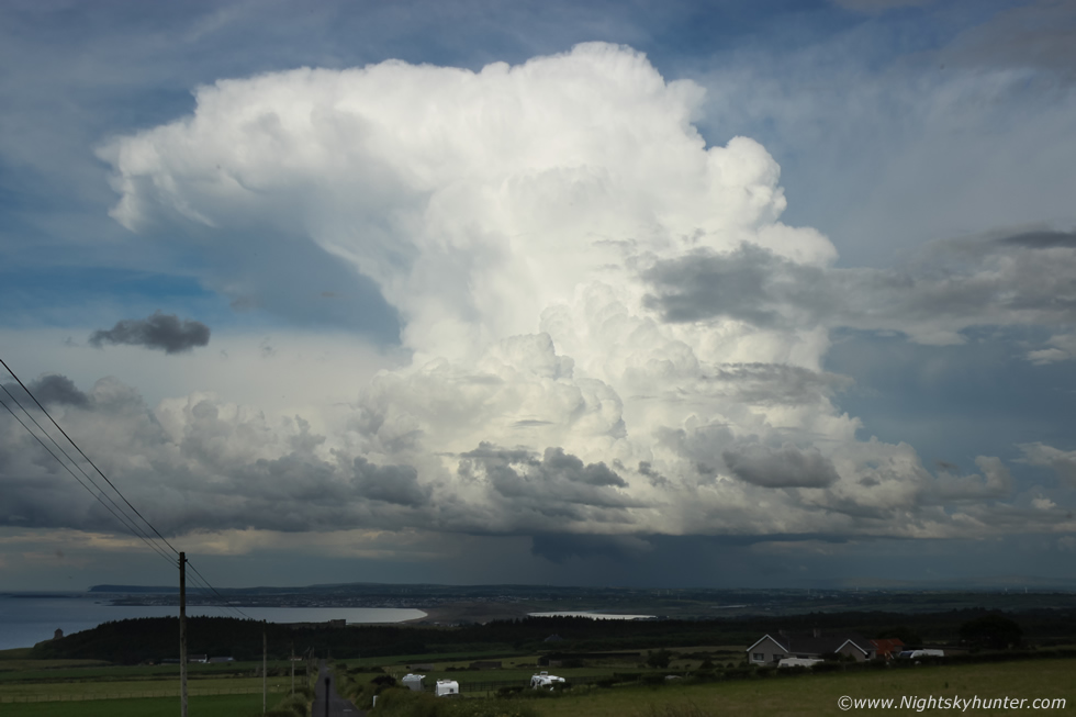 |
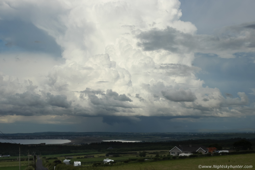
Finally getting it all in the frame now, it was moving away from us and R to L at the same time so we were looking directly at the rear and side or flanking region of the storm. Owen was on the stone wall, his shutter clicking and I was standing on the back bumper of the van and shooting across the top of the roof, periodically we heard distant thunder rumble. From this angle we are viewing the structure of a multicell thunderstorm, we are observing a line of updraught towers of ever increasing height in classic 'stair step' fashion which merge into the central and tallest updraught which has spread out into an anvil downwind from the base, there's even a possible brief overshooting top present, I would have loved to have seen the satellite images of this storm.
 |
Drone video still which really done the scene justice, how lucky we where to be positioned here on an elevated position looking across this iconic coastline, the River Bann and Atlantic Ocean with this beauty of a storm towering above. This image is concentrated on the base and flanking region, the dark wall cloud was now highly developed and persistent, this was the first wall cloud I've seen in years and to get it below this storm was an extra bonus.
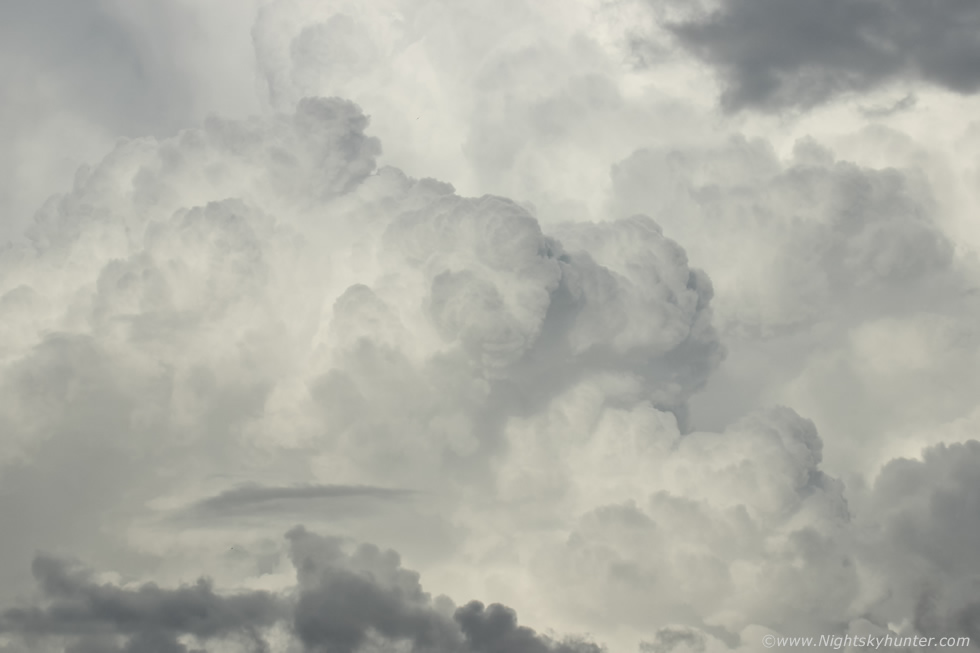 |
Zooming into the updraught half way up the flanking region, in the camera viewfinder I could see the convection expanding in real time like hundreds of balloons being filled with air.
 |
I set the DSLR down then picked up the drone controller, with the Mavic 3 Classic I can zoom in by a factor of x1 to x3 times, this is a digital zoom but it works exceptionally well and I find myself using it much more than I ever expected, for situations like these the function is an absolute treat. Using the control wheel I was able to slowly tilt the camera/gimbal up through the entire updraught plume and back down again to the base, I was in a state of awe when I did this, the view on the screen was amazing. This still is from the top of the camera tilt showing the thunderhead and anvil.
 |
Grabbing the DSLR again zooming into the elemental bombs going off above the base. If you have never witnessed vigorous convection before after a cap break then you don't know what you are missing, it really is incredible to watch, like a time lapse in real time.
 |
Big wall cloud under the updraught base, this is actually the best example of a wall cloud I've ever captured, especially in conjunction with the wider stills showing it in relation to the entire structure. A wall cloud is an abrupt and often blocky lowering below the base directly under the main updraught of the cell. It's a visual sign of highly concentrated moist air rising (inflow) into the base and up into the storm, in other words the storm is feeding and this cloud is a tell tale clue that's very hungry indeed. Rain cooled air condensing from the precip core makes the wall cloud visible, they are either rotating or non rotating. If the former then they are worthy of watching as this is where funnel clouds and tornadoes will form.
 |
Another tip to indicate that what you are seeing is a wall cloud is that it will always have it's lowered portion tilted and pointing directly at the precip core where it's drawing the rain cooled air from, in contrast to this a shelf cloud (outflow feature) will be tilted away from the precip core. Now that I think about it I don't think I've ever captured such a good example of one before and from looking at this image it seems to have been quite a large feature. What I can't understand is why nobody else saw, or better yet, got images of it. This was evening time, anyone to the west of this cell located in proximity to the very busy north coast would have easily seen this wall cloud yet not a single image appeared online, or maybe those who did see it didn't know what it was.
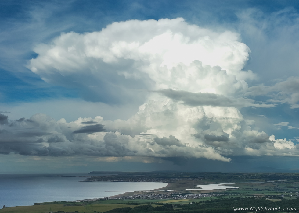 |
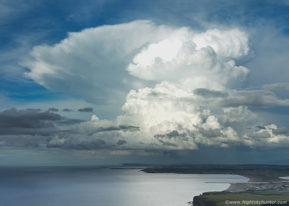
At this point Owen and I were awestruck just saying WOW over and over, I think I was uttering the phrase ''outrageous structure'' combined with quite a lot of cursing, we were on a complete high, we just couldn't believe our eyes. Using the full four thirds sensor on the Mavic 3 Classic here, you can really appreciate how enormous this cell was in relation to foreground subjects, just look at Mussenden Temple to the bottom left for scale. An atomic bomb of water droplets and ice crystals reaching 33,000ft into the atmosphere.
 |
The wall cloud was still visible the entire time, how this storm didn't drop a big funnel or tornado is beyond me, that little lowering at the base of the wall cloud almost looks like a funnel, but it likely wasn't.
 |
Roisin rang again asking where I was at now?, thinking I was half way home by now, I said I'm still at the coast, I said an incredible storm had exploded up in front of me with amazing structure, Roisin was silent for a minute to take in what I was saying, then she understood that something major was happening by the tone of my voice and wished me luck and that she was would see me later. Drone video grab of that complex updraught now in the process of crossing from land to sea.
 |
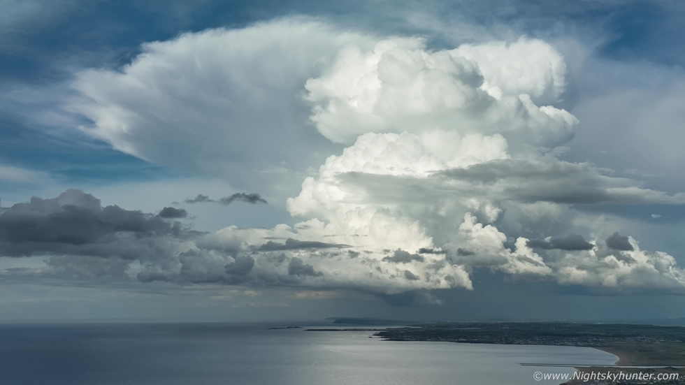
Another Mavic 3 image using the main four thirds sensor and my favourite image of his storm. From close to far, Mussenden Temple, Castlerock Beach, Bar Mouth, Portstewart strand, Portrush, Causeway Cliffs and beyond. Above that landscape is a large rounded wall cloud below the Krakatoa of the skies, you simply just don't see this caliber of convection from N. Ireland, we were witnessing something exceptional and we knew it.
 |
Final drone video still of this beauty, my drone's battery was getting low, it had been filming this storm for over half an hour and documented it during it's entire life span so I landed and switched to a fresh battery just in case. When I looked back at the storm I observed something which immediately caught my eye, was that a funnel?
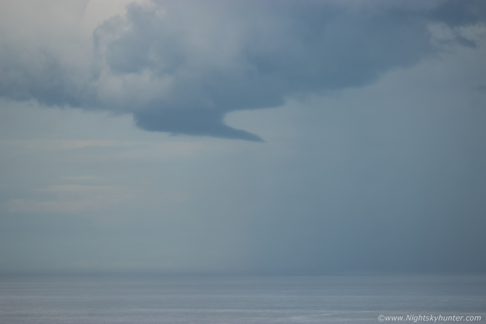 |
The base of the storm had just passed over the sea and from the bottom of the wall cloud's position this strange form appeared, it looked like a funnel cloud to me, Owen and I had to look carefully, was it or wasn't it?, I used the DSLR and zoomed into 400mm. It was too distant to make out rotation, however its smooth form, its location under the base and general appearance all suggested it was likely a funnel, after two minutes of watching I decided it was a funnel based on that visual aspect and Owen agreed. Horizontal funnels are more rare, I've seen a couple over the years during 2007 and 2009 so they do happen, sometimes the gust front from the precip core can undercut the base causing the funnel to tilt to that position.
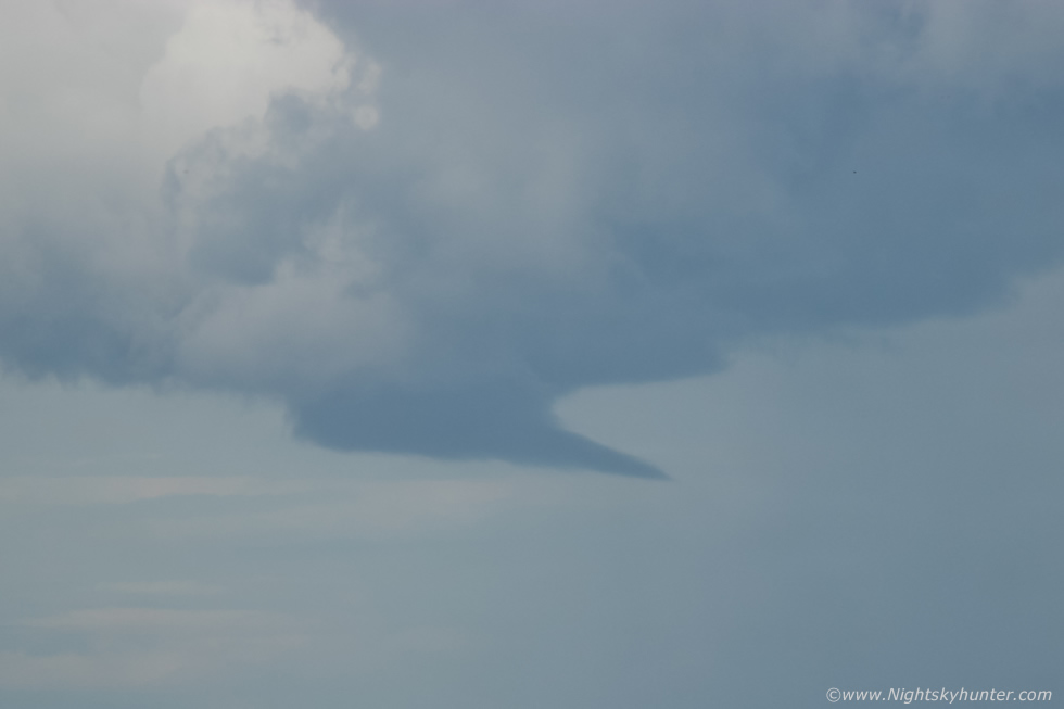 |
A few minutes later it weakened and detached from the lowering, it was brief but it was icing on the convective cake. The storm moved far out over the ocean and we lost sight of it, we had watched it during most of its entire life cycle and had been perfectly positioned to bask in the glory of its structure in full sunshine with not a drop of rain on our heads. I now know why my instincts ignored that turn off for Ballymoney, if I didn't listen to them I would have been rite under that base in the rain, hearing thunder and seeing lightning, but missing out entirely on this wonderful experience, I'm glad I listened to my gut about going to the coast.
Owen and I were buzzing with excitement, standing on that famous stretch of road overlooking some of the finest coastal views of the country after witnessing what can only be described as one of the best looking storms we had ever seen. Roisin rang again to ask how I was getting on, I gave an excited run down on what happened, then she asked are you heading back home now? and just as she asked this Owen pointed out new convection forming inland billowing up, I said another storm is forming, I will be staying late now, it's not often I can say that after 20.00 in the evening on a storm chase in this country. Owen and I watched those new towers growing, they were looking very interesting, little did we know it then but these would turn into the best looking storm any of us had ever seen in our lives. To view footage of the first storm and to find out what happened next make sure to check out part two on my next chase report. Thanks very much for reading.
Martin McKenna
